
Usòrò:Eesti põhjarannik.jpg

Otu nyochaa a ha:800 × 424 piksels Ndị ọzọ mkpebi:320 × 170 piksels | 640 × 340 piksels | 1,024 × 543 piksels | 1,280 × 679 piksels | 2,560 × 1,358 piksels | 12,875 × 6,831 piksels.
Failụ si na nke mbu (12,875 × 6,831 pixel, ívù akwukwo orunótu: 48.22 MB, MIME nke: image/jpeg)
Mmẹkụwátá
| Warning | The original file is very high-resolution. It might not load properly or could cause your browser to freeze when opened at full size. |
|---|
| Nkówá |
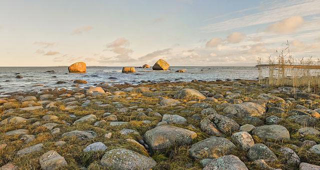
Eesti: Põhja-Eesti kivine rannajoon Pärispea poolsaarel Lahemaa rahvuspargis. English: Pärispea Peninsula, Lahemaa National Park. There are glacial boulders in the picture, that are typical to Estonian northern coast. |
| Ǹgụ́ụ̀bọ̀chị̀ | |
| Mkpọlọ́gwụ̀ | Orü ọnwé |
| Odé ákwụ́kwọ́ | Abrget47j |
| Camera location | | View this and other nearby images on: OpenStreetMap |
|---|
|
This image was selected as picture of the day on Wikimedia Commons for 19 April 2014. It was captioned as follows: English: Pärispea peninsula, Lahemaa National Park, Estonia. Other languages:
Bosanski: Poluostrvo Pärispea, Nacionalni park Lahemaa. Eesti: Põhja-Eesti kivine rannajoon Pärispea poolsaarel Lahemaa rahvuspargis. English: Pärispea peninsula, Lahemaa National Park, Estonia. Nederlands: Het schiereiland Pärispea in het Nationaal Park Lahemaa in het noorden van Estland aan de Finse Golf. 中文: 爱沙尼亚拉赫马国家公园佩里斯佩半岛。 |
Nkwényé
I, the copyright holder of this work, hereby publish it under the following license:
Edebere faịlụ a n'okpuru ikikeree Creative Commons Attribution-Share Alike 3.0 Unported license.
- I wepulara nóru:
- i nye – ikọpị,ikekasi na izịpụ ọru a
- i dowaria – igbanwee ọrụ a
- Ọ ga bụ na ọnọdụ ndi a:
- í-kpó-áhà – Ị ga-enyerịrị ugo kwesịrị ekwesị, nye njikọ na ikikere ahụ, ma gosikwa ma emere mgbanwe. Ị nwere ike ime ya n'ụzọ ezi uche ọ bụla, mana ọ bụghị n'ụzọ ọ bụla na-egosi na onye nyere ikikere kwadoro gị maọbụ ojiji gị.
- gbásàa kà – Ọ bụrụ na ị tụgharịgharịa, gbanwee, ma ọ bụ wulite n'elu ihe ahụ, ị ga-ekesa ndenye gị n'okpuru otu ma ọ bụ ikike dakọtara dị ka nke mbụ.
| Annotations | This image is annotated: View the annotations at Commons |
This image was uploaded as part of Estonian nature photos competition 2013.
|
Ịta nke usòrò
Bìri èhì/ogè k'ị hụ òtù ụ̀fa dị̀ m̀gbè ahụ̀.
| Èhì/Ogè | Mbọ-aka | Ógólógó na asaá | Òjìème | Nkwute | |
|---|---|---|---|---|---|
| dị ùgbu â | 19:53, 9 Disemba 2013 | | 12,875 × 6,831 (48.22 MB) | Abrget47j | horizon straightened |
| 20:34, 3 Disemba 2013 |  | 12,278 × 6,575 (46.86 MB) | (áhá onye na ké a wefụolé) | stitching errors removed | |
| 10:12, 26 Novemba 2013 |  | 12,109 × 7,230 (49.25 MB) | (áhá onye na ké a wefụolé) | User created page with UploadWizard |
Ojiji faịlụ
Ihe ndị na-eso ihe eji Ihu akwụkwọ eme na faịlụ a:
Ejiji failụ zụrụ ọha
Wikis ndi a edeputara na eji kwa failụ a:
- Ihe eji na be-tarask.wikipedia.org
- Ihe eji na bn.wikipedia.org
- Ihe eji na crh.wikipedia.org
- Ihe eji na cv.wikipedia.org
- Ihe eji na de.wikipedia.org
- Ihe eji na en.wikipedia.org
- Ihe eji na et.wikipedia.org
- Ihe eji na fiu-vro.wikipedia.org
- Ihe eji na fr.wikipedia.org
- Ihe eji na hu.wikipedia.org
- Ihe eji na incubator.wikimedia.org
- Ihe eji na ka.wikipedia.org
- Ihe eji na kk.wikipedia.org
- Ihe eji na ko.wikipedia.org
- Ihe eji na krc.wikipedia.org
- Ihe eji na lbe.wikipedia.org
- Ihe eji na lv.wikipedia.org
- Ihe eji na mg.wikipedia.org
- Ihe eji na mk.wikipedia.org
- Ihe eji na os.wikipedia.org
- Ihe eji na pt.wikipedia.org
- Ihe eji na ro.wikipedia.org
- Ihe eji na ru.wikipedia.org
- Ihe eji na ru.wikinews.org
- Ihe eji na sah.wikipedia.org
- Ihe eji na sv.wikipedia.org
- Ihe eji na tr.wikipedia.org
- Ihe eji na tt.wikipedia.org
- Ihe eji na uk.wikipedia.org
- Ihe eji na vi.wikipedia.org
- Ihe eji na www.wikidata.org
- Ihe eji na xal.wikipedia.org
- Ihe eji na zh.wikipedia.org
Lee more global usage of this file.